
YEIDA's Mathura Heritage City and New Agra: The Two Master Plans at the Far End of the Yamuna Expressway, in Numbers
05 October 2026 · Rise Propworld Team
A data story on YEIDA's plans at the Agra end of the Yamuna Expressway: the Raya Urban Centre and Mathura heritage city, and the New Agra urban centre, with land use, population and what buyers should check.
11,654 hectares. 9.66 lakh people. 13% of the land set aside for tourism.
Those are the numbers in YEIDA's master plan for Raya, the urban centre where the Mathura heritage city is planned. Keep driving down the Yamuna Expressway to Agra and there is a second plan, for "New Agra", with room for 14.6 lakh people on 12,200 hectares.
Many buyers think YEIDA means Jewar. The authority's map actually runs all the way to Agra. This is the data story of the far end of the corridor, told with the numbers in the official plans and the news reports that covered them.
How big YEIDA really is
India TV reported in March 2025, when the state approved YEIDA's Master Plan 2031, that YEIDA's notified area covers 3,352 sq km across six districts, and spans 1,149 villages in Gautam Buddh Nagar, Bulandshahr, Agra, Aligarh, Mathura and Hathras.
Phase II alone accounts for about 2,593 sq km across four districts:
- Mathura
- Agra
- Aligarh
- Hathras
So when a broker in Mathura says "this is a YEIDA area", it may be true. The question is which plan, which zone and which land use.
Raya Urban Centre: the Mathura heritage city plan, in numbers
YEIDA's amended Raya Urban Centre Master Plan 2031 report gives the hard numbers.
| Item | Raya Urban Centre |
|---|---|
| District | Mathura |
| Planning area | About 11,654 hectares |
| Projected population, 2031 | About 9.66 lakh |
| Gross density | About 83 persons per hectare |
| Location | At the intersection of the Yamuna Expressway and SH-33 |
| Main focus | Tourism, with religious tourism as the main theme |
The report says the heritage city component was added through amendments and is aimed at "preservation alongside modern development near old Vrindavan city". It also notes Raya's links to the wider Braj circuit, including Gokul and Mahaban.
How Raya's land is split
| Land use | Share of area |
|---|---|
| Residential, including village areas | 26.54% |
| Green spaces and recreation | 16.48% |
| Transportation | 13.66% |
| Tourism zone | 13.05% |
| Public and semi-public | 9.23% |
| Industrial | 7.32% |
| Commercial | 6.02% |
The standout number is the tourism zone at about 13%. That is a city planned around visitors: hotels, convention centres and cultural facilities, according to the report. Industry gets a much smaller share.
What this means on the ground: if you are looking at Mathura or Vrindavan property, the plan points towards hospitality, second homes and pilgrim traffic, not factory jobs. Our earlier piece on flats in Vrindavan shows how strong that demand already is in search data.
New Agra: the Agra Urban Centre plan, in numbers
Further south, YEIDA's Agra Urban Centre is the plan the media calls "New Agra". The Daily Jagran reported its draft details in April 2025.
| Item | New Agra (Agra Urban Centre) |
|---|---|
| Villages | 58, in Agra district |
| Planning area | About 12,200 hectares |
| Planned population | About 14.6 lakh |
| Projected jobs | About 8.5 lakh |
| Logistics hub | About 180 hectares |
| Education and healthcare | About 330 hectares |
| Yamuna buffer zone | About 823 hectares |
How New Agra's land is split
| Land use | Share |
|---|---|
| Residential | 27.7% |
| Industrial | 20.11% |
| Roads and infrastructure | 12.6% |
| River buffer zone | 8.2% |
| Green area | 5.4% |
| Mixed use | 5% |
| Commercial | 3.8% |
| Recreational tourism | 3.6% |
| Agriculture and forest | 3% |
| Institutional | 2.7% |
| Logistics | 2% |
| Tourism | 2% |
| Commercial tourism | 1.6% |
| Service sector | 1% |
Compare the two tables and the personalities are clear. Raya is a tourism city with about 7% industrial land. New Agra is a jobs city with about 20% industrial land and a target of 8.5 lakh jobs.
Where things stand now
Plans are not cities. Here is what the record says about status:
- Raya: the amended Master Plan 2031 report is published by YEIDA.
- New Agra: at YEIDA's 93rd board meeting on 28 September 2026, the board reviewed the Agra Urban Centre Master Plan-2041, according to The Impressive Times. Reviewed is not the same as notified or built.
Our explainer on the 93rd board meeting covers what else was on that agenda.
Getting there: the expressway exits that matter
Per Wikipedia, the Yamuna Expressway runs 165.5 km from Pari Chowk in Greater Noida to Kuberpur in Agra, with major interchanges at Jewar, Tappal, Mathura (NH 530B) and Khandauli (NH 509).
- For Raya, Mathura and Vrindavan, the Mathura interchange is your exit.
- For Agra, you run to the end at Kuberpur, with Khandauli before it.
Our Greater Noida to Agra corridor piece explains why we think this whole stretch is one market story.
What a careful buyer does with this data
- Ask for the zone, not the "YEIDA" label. A plot in a tourism zone, a green belt or a river buffer has very different rights from a residential sector.
- Check whether the land is inside an area being acquired. Read our guide to plots near Jewar Airport. The same four plot types and checks apply down the corridor.
- Treat population targets as targets. A plan for 9.66 lakh people by 2031 is an ambition. Visit and count the people who live there today.
- Match the plan to your purpose. A holiday or retirement home near Vrindavan fits Raya's tourism story. A rental bet on factory workers fits New Agra better, but only once jobs arrive.
If you want land closer to Greater Noida while the Agra end fills in, two options we track: Prakriti Luxury Farm Houses near Tech Zone for farmhouse plots, and Eldeco Echoes of Eden in Sector 22D on the Yamuna Expressway.
And if you are still choosing between NCR corridors, our Dwarka Expressway vs Yamuna Expressway comparison puts the two side by side.
Frequently asked questions
What is YEIDA's Mathura heritage city?
It is the heritage city component of YEIDA's Raya Urban Centre in Mathura district, added to the Raya Master Plan 2031 through amendments, with a focus on religious tourism near old Vrindavan.
How big is the Raya Urban Centre?
About 11,654 hectares, with a projected population of about 9.66 lakh by 2031, according to YEIDA's amended master plan report.
What is New Agra?
The common name for YEIDA's Agra Urban Centre: about 12,200 hectares across 58 villages in Agra district, planned for about 14.6 lakh people and 8.5 lakh jobs, as reported by The Daily Jagran.
Which districts are in YEIDA Phase II?
Mathura, Agra, Aligarh and Hathras, covering about 2,593 sq km.
Is it safe to buy land in YEIDA's Mathura area now?
Only after confirming the land use zone, title, acquisition status and access. A master plan shows intent. It does not make any single plot safe.
From Pari Chowk to Agra, ask the people who drive it
We work the full Yamuna Expressway, not just the Greater Noida end, and we will tell you plainly whether a Mathura or Agra plot fits your plan.
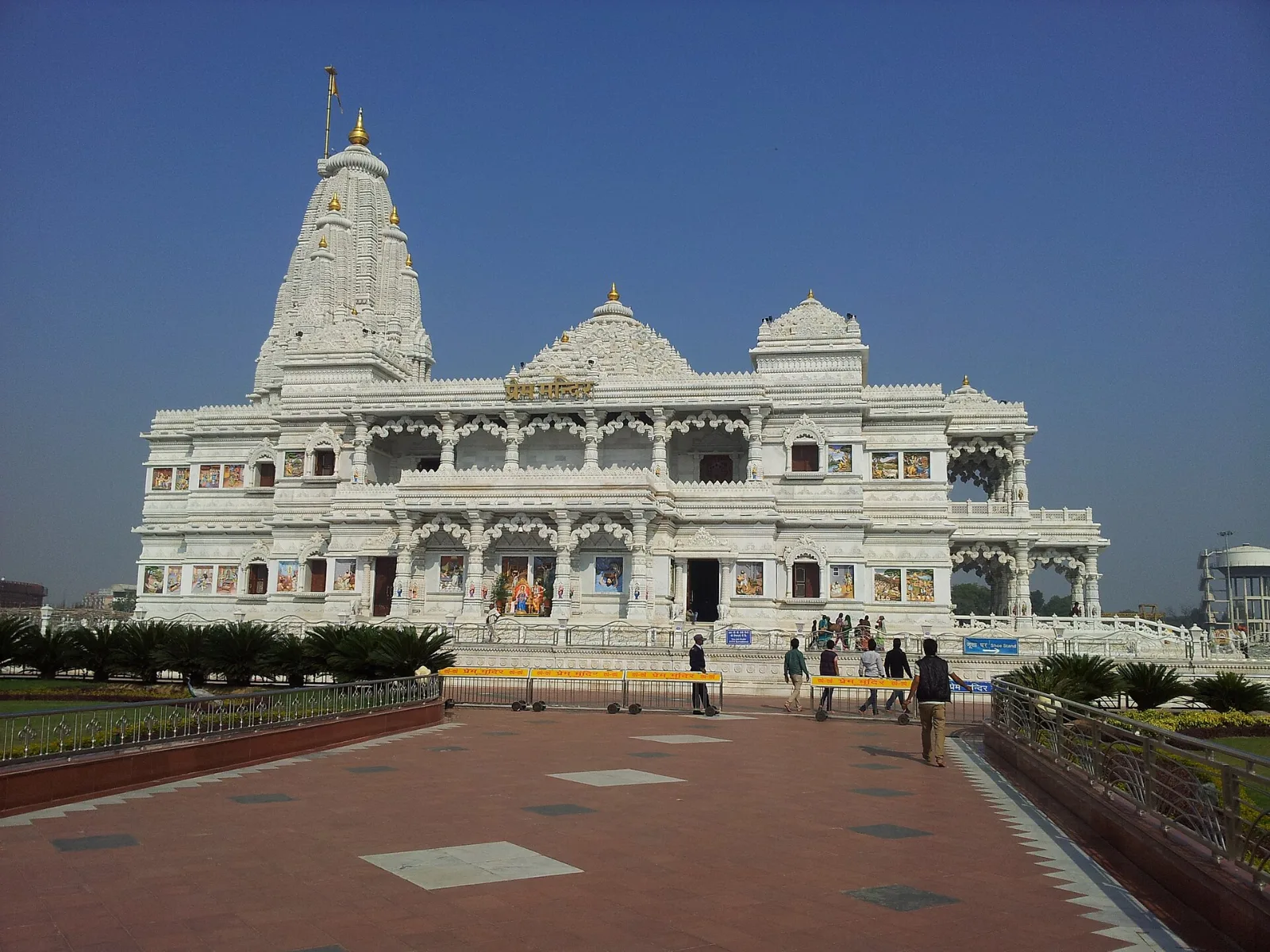
Hero image: "Krishna temple vrindavan morning" by Ketandelhiwala, CC BY-SA 4.0, via Wikimedia Commons.
Sources: YEIDA, Raya Urban Centre Master Plan 2031 (amended) full report; India TV, "YEIDA Master Plan 2031 gets government nod" (25 March 2025); The Daily Jagran, "New Agra Master Plan Unveiled: YEIDA Plans To House 14.6 Lakh People, Create 8.5 Lakh Jobs" (9 April 2025); The Impressive Times, YEIDA 93rd board meeting (28 September 2026); Wikipedia, "Yamuna Expressway".